🏔 Wales, UK
The Complete Guide to the Mach Loop
Watch military jets train at low level through Welsh valleys. Viewing locations, photography tips, when to go, and where to stay. The original Mach Loop Guide since 2011
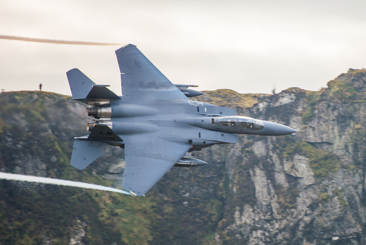
250 ftMinimum flying height
~450 knotsUp to 500 mph
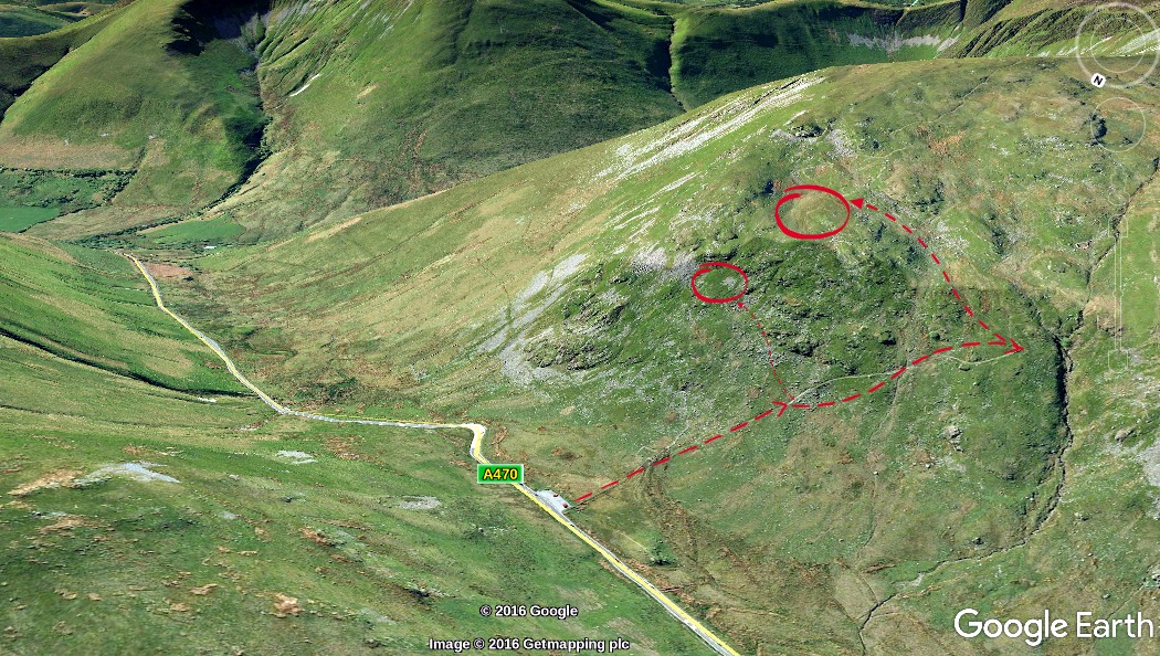
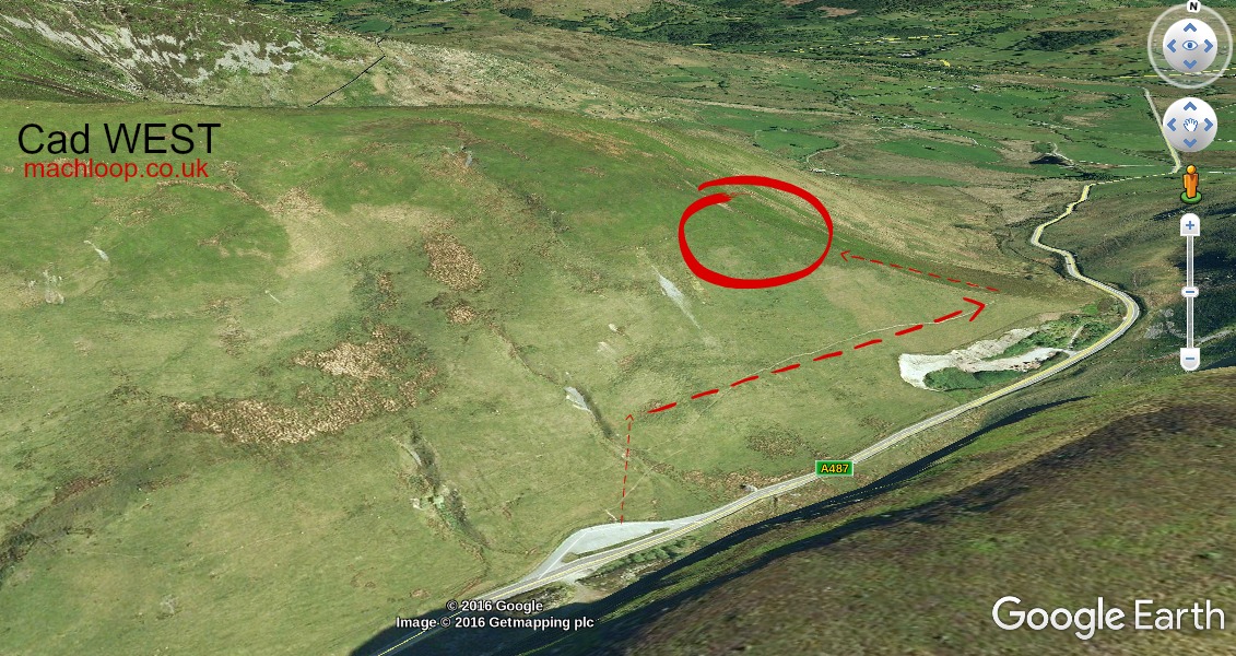
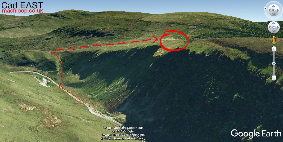
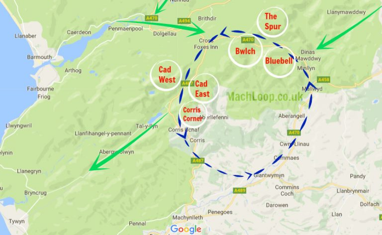
8+Viewing spots
Mon–FriTypical flight days