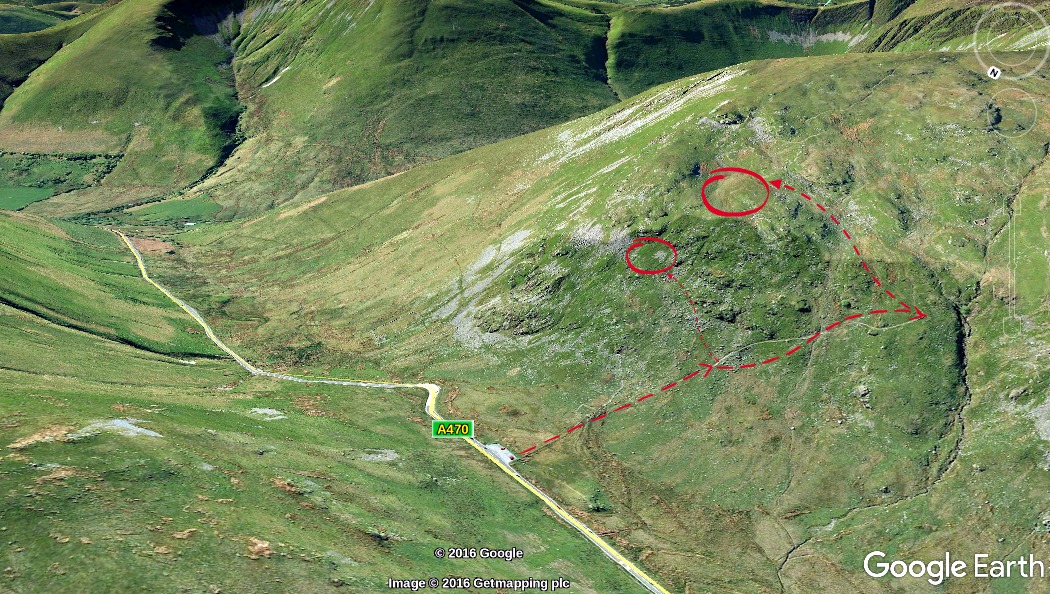
The Bwlch is the most famous and most visited viewpoint in the entire Mach Loop. Located five miles east of Dolgellau on the A470, standing here you look directly down into the throat of a narrow valley and watch aircraft snake through its twists below you.
There are two main positions to aim for. The top ledge — around 400ft of climb — gives the classic elevated look-down view seen in most Bwlch photographs. The middle ledge, at roughly 200ft of climb, is a good option when the top is crowded or weather makes the higher ground difficult.
What you'll see
Aircraft travel generally left to right when facing into the valley. Morning light falls across upper surfaces, making early starts particularly rewarding for photographers.
Getting there and parking
Nearest postcode: LL40 2SH. Lay-bys on the A470 accommodate around 20 cars and fill early on busy days — aim to be parked by 08:30. Boots are essential on the uneven path even in dry weather.