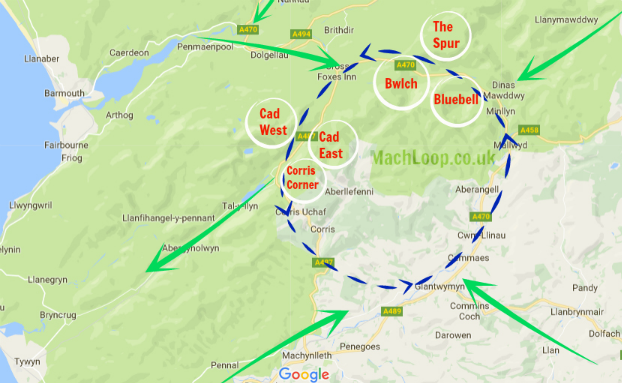
The Mach Loop is a set of valleys, situated between Dolgellau in the north, and Machynlleth in the south (and from which the Mach Loop gets its name), which are regularly used for low level flight training, with flying as low as 250 feet (76 metres) from the nearest terrain.

To the south of the Mach Loop there is an area called Tactical Training Area 7T, in which, at specified times, the aircraft may fly as low as 100 feet (30.5 Metres). The Royal Air Force publish a timetable of when the Tactical Training Areas may be in use, however experience shows this to be of little use in determining whether low level flying will take place on a particular day or time.
Low flying is an vital skill for military aircrew, and the Royal Air Force uses various areas of the United Kingdom for low level flight training. The United Kingdom is split into 18 low flying areas, (or “LFAs”), the LFA’s being numbered 1-19 (strangley there is no LFA15). The Ministry of Defence website has a map showing the location of the low fly areas. The Mach Loop is located within LFA7, which covers the whole of Wales, except for a small section in the north-east of Powys, which is within LFA9.
Fly the Virtual Mach Loop in Microsoft Flight Simulator
Flying the Mach Loop virtually is as-close as many of us will ever get to experiencing it. Check out our MSFS Mach loop guide!
Mach Loop Cockpit View from a RAF Typhoon